Discover the Power of Trig Points & Trig Bagging!
Trig Bagging aside, I wanted to take a step back and share what I’ve learned so far!
As mentioned, trig bagging aside, triangulation (trig) points are a powerful tool used to measure distances and lines of sight. They are pillars of stone or metal placed at fixed points on high points. These pillars have been used for centuries to accurately measure distances and angles between points. In this guide, we will explore the history of trig points, what trig pillars are and how to use them. We’ll also take a look at trig bagging and the benefits of using trig points. So, let’s dive in and discover the power of trig points!
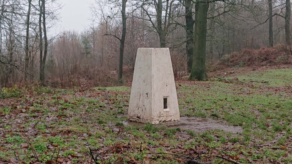
Introduction to Trig Points
Trig points, also known as triangulation points, are pillars of stone or metal placed at fixed high points across the landscape used for surveying and measuring distances and angles between points. Trig points are used in all kinds of surveying and navigation, from mapping to precision engineering. They are an essential part of any surveyor’s toolkit, allowing them to take accurate measurements and create precise maps.
Trig points have been used for centuries, but the modern-day trig point was first developed in the 18th century. It was initially created for the purpose of accurately measuring distances for military purposes. Since then, trig points have been used for a variety of purposes, from surveying and mapping to precision engineering.
Trig points are an essential part of any surveyor’s toolkit. They are used to accurately measure distances, angles, and lines of sight. They are also used to create precise maps and to accurately measure elevations and slopes. Trig points are an important tool in a variety of surveying and engineering projects, from road and building construction to land surveying and mapping.
What is a Trig Point?
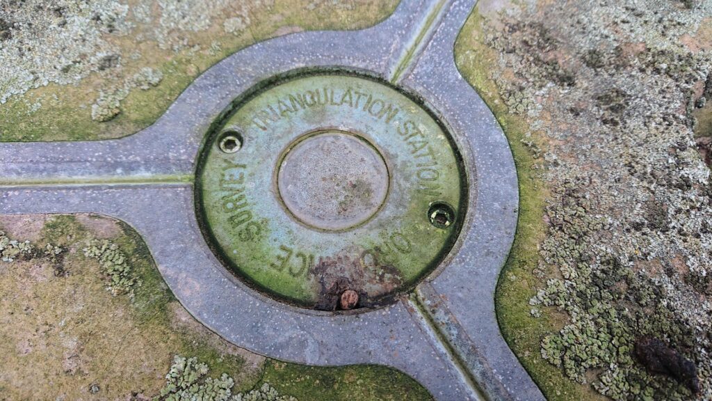
A trig point is a pillar of stone or metal placed at a fixed point on the earth’s surface. The pillar is marked with a unique identifier and the coordinates of the point. This allows surveyors to easily locate the point and measure distances and angles between points. The pillar also includes a benchmark, which is a reference point used to measure altitude.
Trig points are placed at specific points across the landscape, usually at prominent landmarks or at the corners of surveyed areas. They can be found all over the world, from remote mountain peaks to city streets.
Trig points are marked with a unique identifier, such as a number or letter. This identifier is used to locate the point and measure distances and angles between points. The identifier also serves as a reference point for other surveyors and engineers.
History of Trig Points
Trig points have been used for centuries, but the modern-day trig point was first developed in the 18th century. It was initially created for the purpose of accurately measuring distances for military purposes. Since then, trig points have been used for a variety of purposes, from surveying and mapping to precision engineering.
Trig points were first used in Britain in the late 1700s. They were used to measure distances and angles between points for military purposes. Trig points were also used to create accurate maps of the British Isles.
Trig points have been used in a variety of applications since then, from road and building construction to land surveying and mapping. They are an essential part of any surveyor’s toolkit, allowing them to take accurate measurements and create precise maps.
What is a Triangulation Station?
A triangulation station is a point on the earth’s surface that is used to measure distances and angles between points. Triangulation stations are usually marked with a trig point, which is a pillar of stone or metal placed at a fixed point. The pillar is marked with a unique identifier and the coordinates of the point. This allows surveyors to easily locate the point and measure distances and angles between points.
Triangulation stations are used to measure the distance between two points on the earth’s surface. This is done by measuring the angles between the two points and then using trigonometric calculations to determine the distance between them. Triangulation stations are also used to measure the elevation of points on the earth’s surface.
What is a Trig Pillar?
![]()
A trig pillar is a pillar of stone or metal placed at a fixed point on the earth’s surface. The pillar is marked with a unique identifier and the coordinates of the point. This allows surveyors to easily locate the point and measure distances and angles between points.
Trig pillars are used for a variety of purposes, from surveying and mapping to precision engineering. They are an essential part of any surveyor’s toolkit, allowing them to take accurate measurements and create precise maps.
Trig pillars are usually placed at prominent landmarks or at the corners of surveyed areas. They can be found all over the world, from remote mountain peaks to city streets.
Triangulation Pillar Locations
Trig pillars can be found all over the world. They are usually placed at prominent landmarks or at the corners of surveyed areas. The exact location of a trig point can be determined by looking up the coordinates of the point.
In the United States, trig pillars are usually placed along the National Geodetic Survey (NGS) network. This network is a network of survey markers used to measure distances and angles between points. The NGS network includes more than 4 million survey markers across the United States.
Examples of trig points on maps…
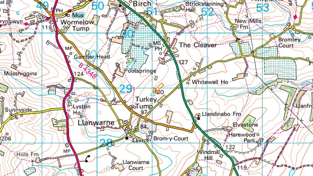
Grid reference: SO 51016 28906 | T:UK waypoint: TP5092 | Click image to visit www.streetmap.co.uk
In the United Kingdom, trig pillars are usually placed along the Ordnance Survey (OS) network. This network is a network of survey markers used to measure distances and angles between points. The OS network includes more than 6 million survey markers across the United Kingdom.
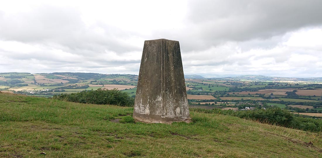
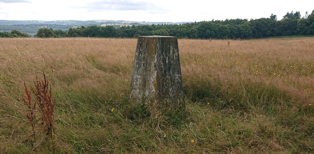
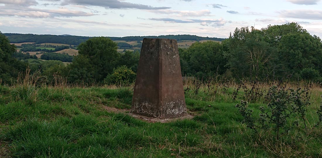
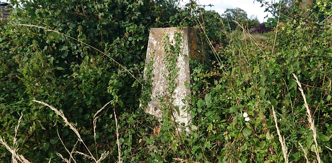
Here are all 70 trig point locations in Herefordshire for any avid trig baggers out there!
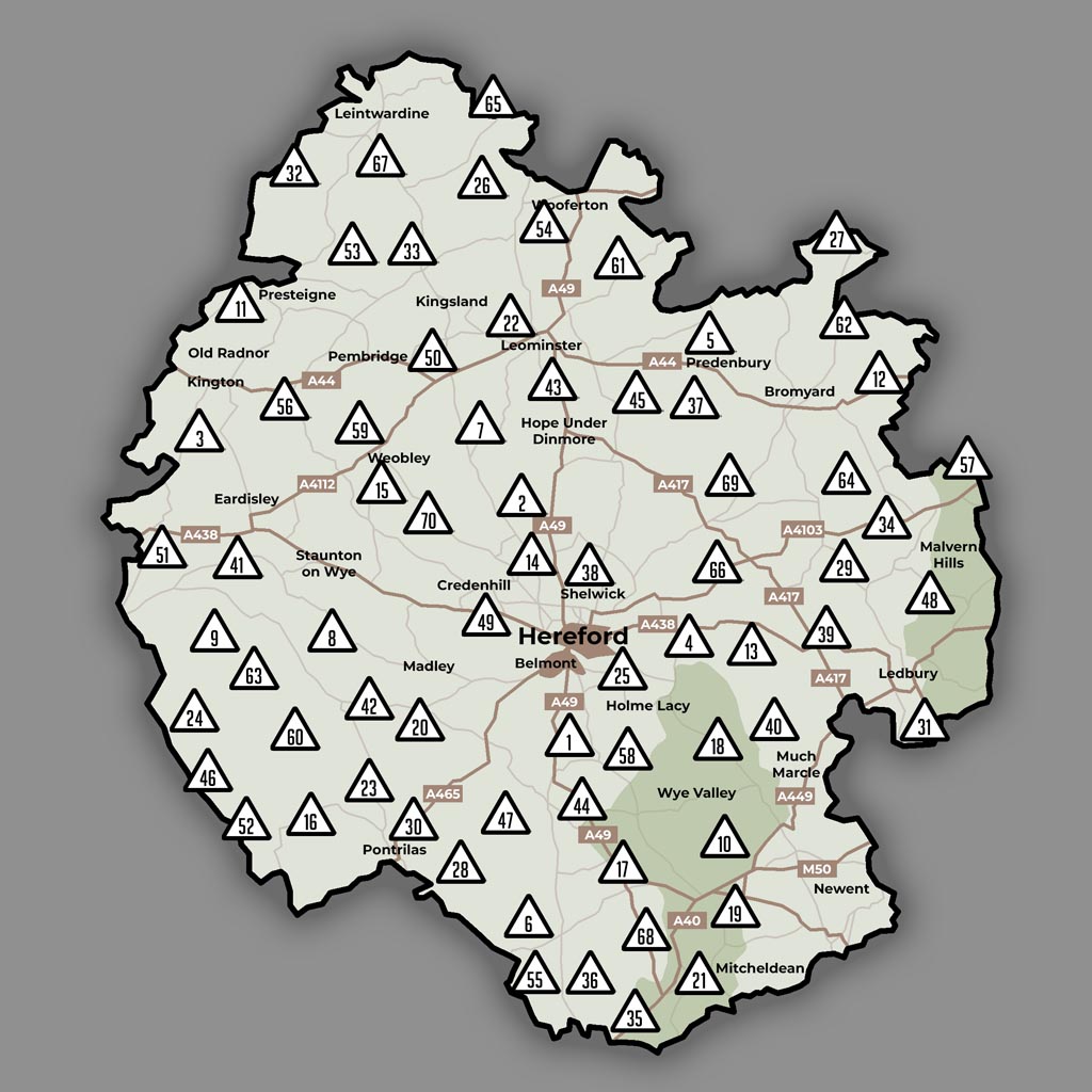
Now I’ve touched on Trig Pillars, and their purpose, let’s move on to Trig Bagging!
What is Trig Bagging?
Trig bagging is the practice of visiting and recording the locations of trig points. Baggers usually use a GPS device to record the coordinates of the trig point and then add them to an online database.
Trig bagging is a popular hobby among surveyors, geographers, and outdoors enthusiasts. It is a great way to explore the outdoors, learn about surveying, and discover new places. It is also a great way to meet other like-minded people and share your knowledge and experiences.
Trig bagging is a great way to explore the outdoors and learn about surveying and mapping. It is also a great way to meet other like-minded people and share your knowledge and experiences.
How to Use a Trig Point
Using a trig point is relatively easy. First, you need to locate the point. This can be done by looking up the coordinates of the point or by using a GPS device. Once you have located the point, you can measure distances and angles between points.
To measure distances and angles between points, you need to use a surveyor’s level and a surveyor’s tape. A surveyor’s level is an instrument used to measure angles between points. A surveyor’s tape is used to measure distances between points.
Once you have measured the distances and angles between points, you can use trigonometric calculations to determine the exact distance between the two points. This information can then be used to create precise maps and to accurately measure elevations and slopes.
Benefits of Using Trig Points
Using trig points has many benefits. First, trig points are an essential part of any surveyor’s toolkit, allowing them to take accurate measurements and create precise maps. Second, trig points are a great way to explore the outdoors and learn about surveying and mapping. Third, trig points are a great way to meet other like-minded people and share your knowledge and experiences.
Using trig points also has many practical benefits. Trig points can be used to measure distances and angles between points. This information can then be used to create accurate maps and to accurately measure elevations and slopes. Trig points can also be used to measure the altitude of a point, which can be useful for navigation and surveying.
Trig Point Resources
If you are interested in learning more about trig points, there are plenty of resources available. Here are a few resources to get you started:
The Ordnance Survey (OS) website is another great source of information on trig points. The website includes a database of more than 6 million survey markers across the United Kingdom.
The Trig Bagging website is a great resource for trig baggers. The website includes a database of more than 60,000 trig points across the United Kingdom.
My Trig Bagging Herefordshire Instagram profile is a great resource for trig bagging and trig baggers. The page includes photos of trig points and tips on how to find them.
You can visit my profile on Trig Pointing UK here: https://trigpointing.uk/info/view-profile.php?u=20491
What to take away from this blog…
Trig points are a powerful tool used to measure distances and lines of sight. They are pillars of stone or metal placed at fixed points and have been used for centuries to accurately measure distances and angles between points. In this guide, we have explored the history of trig points, what trig pillars are and how to use them. We’ve also taken a look at trig bagging and the benefits of using trig points.
Trig points are an essential part of any surveyor’s toolkit, allowing them to take accurate measurements and create precise maps. They are also a great way to explore the outdoors and learn about surveying and mapping. If you are interested in learning more about trig points, there are plenty of resources available.
So, if you’re looking for a way to explore the outdoors, learn about surveying and mapping, or meet other like-minded people, trig bagging is a great option. So, go out and discover the power and appeal of trig points and trig bagging! Check out all the trig points I’ve bagged throughout Herefordshire so far here!


Pingback: Discover Herefordshire’s Hidden Gems Through Trig Bagging | Trig Bagging Herefordshire